SpatialEdge
NepCol’s service will be provided through its cutting-edge software of SpatialEdge.
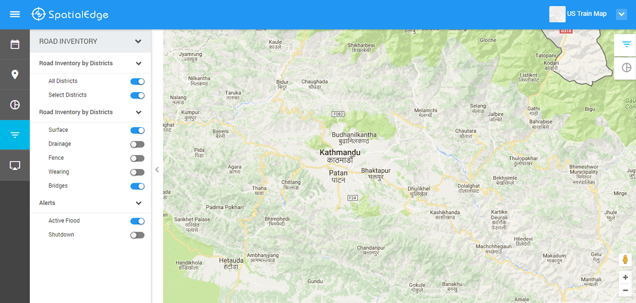
Instead of multiple systems, sometime at odd with each other,SpatialEdge allows engineers, data managers, emergency responders, and decision makers to get a comprehensive view of situational awareness about assets, population, and rapidly evolving natural and man-made disasters in an unified platform to be able to make use of it for taking decisions.
Advantages of using SpatialEdge:
- Integration:There is not one single system in the market that integrates GeoSpatial technology, business intelligence and content management system at programming level. SpatialEdge is the most robust and scalable system compared to others. Most of the other system are loose coupling at data input/output level so maintaining and operating such system is difficult, and the system itself is not robust enough.
- Price: With SpatialEdge, one is not tied up with commercial software – so the cost is low with no restrictions in licensing. One can scale up the system to any level, any number of sub-systems without paying a large sum for additional licenses.
- User-Friendly: The system is open so additional features can be easily added.
- Modern: SpatialEdge uses the latest and state of the art software development practice. We use HTML5, leaflet, PHP laravel framework among others.
- The Cloud: SpatialEdge is perfectly suited for cloud based system.